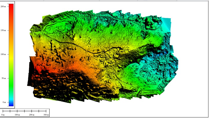
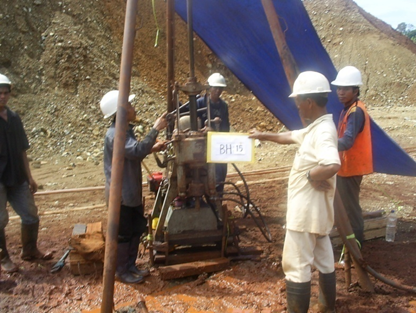
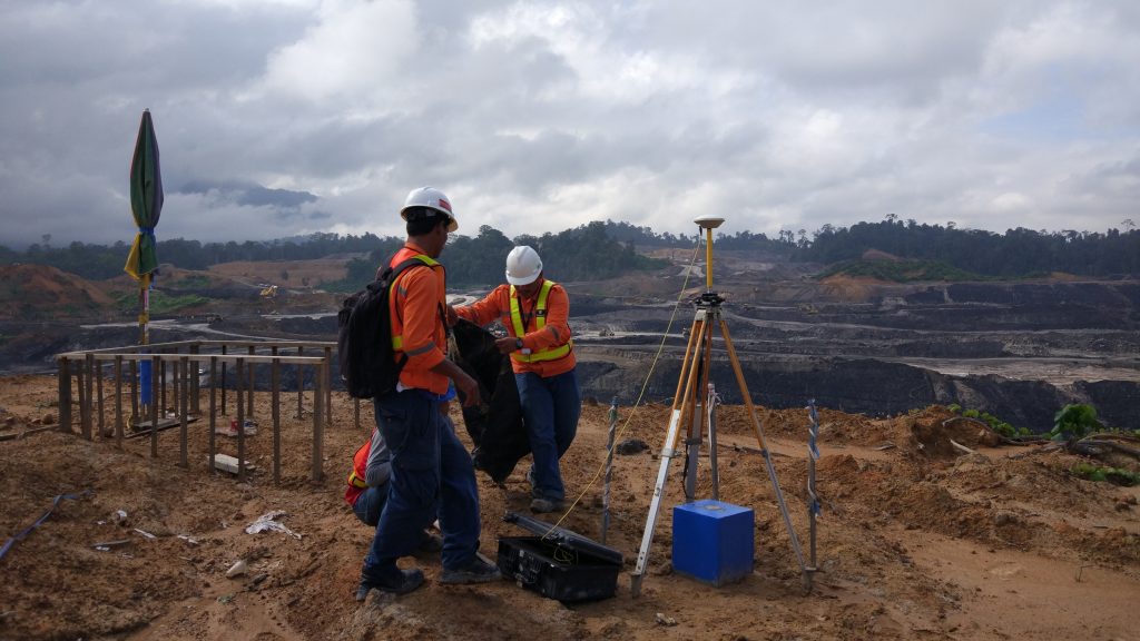
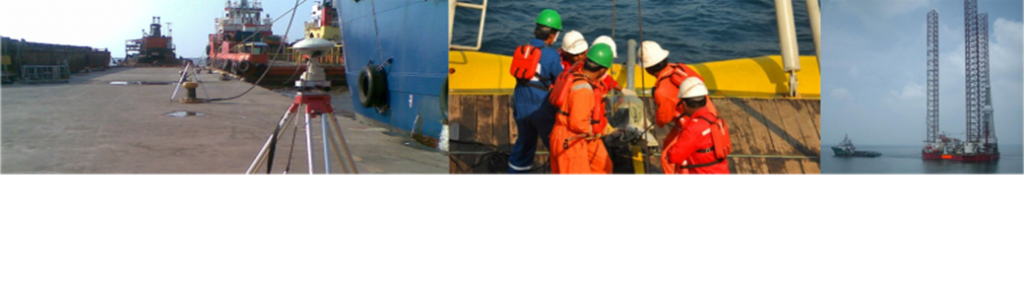
Services GEOGRAPHIC INFORMATION SYSTEM AND REMOTE SENSING Satellite Image Processing; image purchasing, image processing,GCP measurement, urban/city planning,oil/gas/mining/hydropower exploration, cadastral survey, infrastructure, etc.Geographic Information System (GIS); pipeline database, road database, gas distribution database, tax map, hazard map, etcLight Detection and Ranging (LiDAR); mining, agriculture, infrastructure and buildings, oil and gas, forestry.UAV PhotogrammetryMapping and Modelling ; palm cencus, contour mapping, boundary, forestry, mining, pipeline route, road route, etcUAV for project, pipeline surveillance, security/site monitoring Contact GEOPHYSICAL & GEOLOGICAL EXPLORATION On/Near shore Geotechnical/Soil InvestigationsGeologicaland Geophysical Survey/MappingGeological Modelling and Seismic Interpretation2D Onshore and MarineShallow Seismic Acquisition, Processing, QCGeoelectric exploration : water, mining explorationGPR, refraction, CSAMT : mining, oil and gas, construction support, underground utilities mapping, hydropower, etc Contact TOPOGRAPHIC SURVEYING Seismic acquisition support/assistMining /hydropower/renewable energy explorationInfrastructure and buildings support surveyStake out survey and detailed mappingAsbuilt survey and Drill rig site planDeformation/Slope/Subsidence monitoring3D mapping laser scanner: asbuilt surveyGPS Observation & GCP measurementPipeline /power line/road route survey Contact HYDROGRAPHIC SURVEYING On/Near/Off-shore singlebeam and multibeamsurveyAnalogue geophysical (site) survey: Side Scan Sonar, SBP (Sub Bottom Profiling), Bathymetry, MagnetometerPipeline/cable route survey, Existing pipeline/cable surveyPipe/cable laying survey & Pre-post trenching assistOffshorepositioning; rig moving, assist geotechnical, assist diver, barge moving, ROV positioningNearshore geotechnical investigationsDredging support survey and marine sand surveyMetocean investigationsShipping channel survey/investigationsMarine geohazard surveyMarine seismic acquisition support Contact